 HURRICANE ALLEY
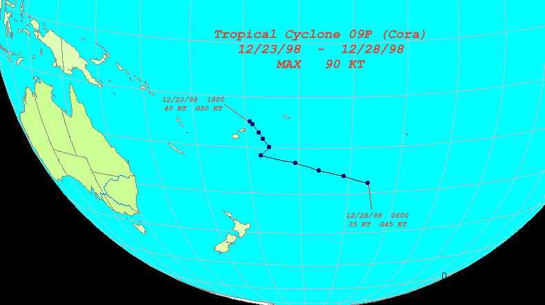
Track of Tropical Cyclone CORA (09P). To view an expanded version click on the image.
Graphic made using HurricaneWatch 98
Storm DataAdv. # Date Time Latitude Longitude Sustained kts Gust kts Movement Speed kts 1 12/23/1998 1800 14.8 S 179.1 W 40 50 2 12/24/1998 0600 15.3 S 178.6 W 60 75 136 3.5 3 12/24/1998 1800 16.9 S 177.5 W 75 90 147 9.6 4 12/25/1998 0600 18.2 S 176.7 W 75 90 150 7.5 5 12/25/1998 1800 19.9 S 175.6 W 90 110 149 10.0 6 12/26/1998 0600 21.7 S 177.4 W 90 110 223 12.3 7 12/26/1998 1800 23.1 S 170.7 W 85 100 103 31.8 8 12/27/1998 0600 24.7 S 166.1 W 85 100 111 22.5 9 12/27/1998 1800 26.1 S 161.1 W 75 90 107 23.6 10 12/28/1998 0600 27.8 S 156.0 W 35 45 111 24.3 FINAL WARNING ISSUED 12/28/1998
![]()
Hurricane Alley Home
Comments:
This site is trakked by Net-Trak!
®© TOMB, 1998,1999.