 HURRICANE ALLEY
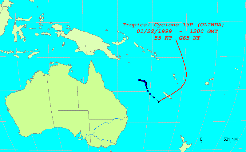
Graphic made using HurricaneWatch 98
Adv. # Date Time Latitude Longitude Sustained kts Gust kts Movement Speed kts 1 01/19/1999 0600 16.6 S 156.4 E 25 35 2 01/19/1999 1200 16.7 S 156.8 E 25 35 105 4.0 3 01/19/1999 1800 16.8 S 157.4 E 25 35 100 5.8 4 01/20/1999 0000 16.9 S 157.9 E 30 40 102 4.9 5 01/20/1999 0600 17.0 S 158.1 E 30 40 118 2.2 6 01/20/1999 1200 17.2 S 158.3 E 30 40 136 2.8 7 01/20/1999 1800 17.4 S 158.5 E 30 40 136 2.8 8 01/21/1999 0000 17.8 S 158.6 E 30 40 167 4.1 9 01/21/1999 0600 18.3 S 158.7 E 30 40 169 5.1 10 01/21/1999 1200 19.1 S 158.9 E 30 40 167 8.2 11 01/21/1999 1800 20.0 S 159.3 E 40 50 157 9.8 12 01/22/1999 0000 20.9 S 160.2 E 55 70 137 12.3 13 01/22/1999 0600 22.0 S 161.3 E 55 70 137 15.0 14 01/22/1999 1200 23.3 S 163.0 E 55 70 130 20.4 Current Information

